Bled is a city in northwestern Slovenia. It is located in Upper Carniola, on Lake Bled, at the foot of the Julian Alps, 45 km from the borders with Austria and Italy.
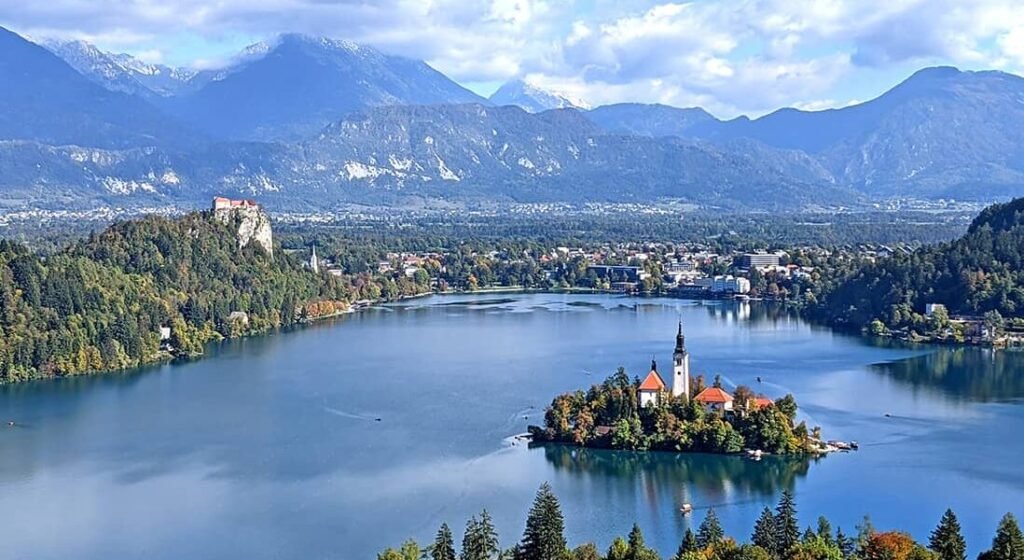
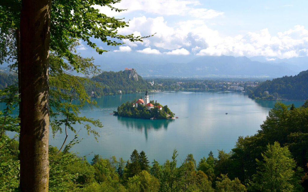
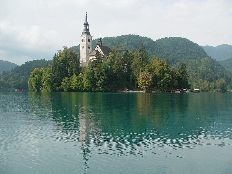
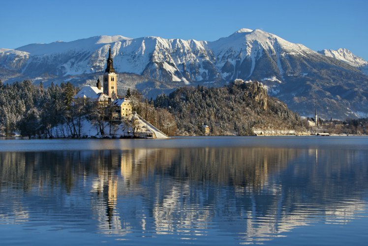
- Bled is a glacial lake in the Julian Alps, in northwestern Slovenia. It covers an area of 1.44 km². The lake was formed in an old tectonic depression at the end of the last ice age, as a result of the melting of the great Bohinj Glacier. No major surface streams flow into the lake; instead, it is fed by underground springs. The lake’s tectonic origins are underscored by active thermal springs in its northeastern part, which is why the lake’s water temperature reaches +26°C. It is one of the warmest Alpine lakes. In the western part of the lake is the island of Blejski Otok, with the pilgrimage church of the Assumption of the Virgin Mary.

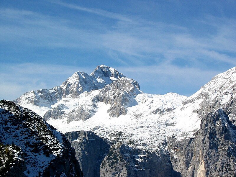
- Triglav National Park (Slovenian: Triglavski narodni park, abbreviated TNP) is the only national park in Slovenia, located in the Julian Alps in the northwestern part of the country (near the border with Italy and Austria). Its name comes from Mount Triglav, the highest peak in Slovenia, which rises almost in the center of the park and dominates its entire area.
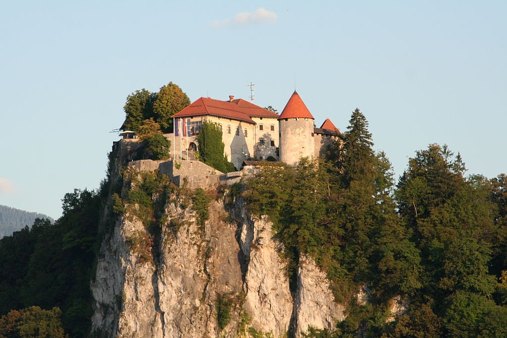
- Bled Castle is a castle situated on a hill 100 meters above Lake Bled, in the town of Bled, in northwestern Slovenia. The oldest part of the castle is the Romanesque tower. During the Middle Ages, the castle’s fortifications were strengthened, reinforcing the walls with additional defensive towers. The castle also features a drawbridge and a moat. Other parts of the castle were built in the Renaissance style, arranged around two courtyards connected by stairs. In the upper courtyard is a chapel, built in the 16th century and renovated around 1700, at which time it was also decorated with illusionistic frescoes.
- Catholic Church. Bled. Slovenia. Church of the Assumption of the Blessed Virgin Mary. A historic church situated in a quiet, picturesque setting on an island accessible by boat.
- Lake Bled viewpoints. During your walk, it’s worth leaving the trail and climbing one of the lake viewpoints. These are Ojstrica (611 m above sea level), Mala Osojnica (685 m above sea level, which we reached), and Veľká Osojnica (756 m above sea level). The entrances to the trails are located in the forest opposite the islet; it’s best to check them on Google Maps. The scenery from the viewpoints is beautiful – you can see the entire lake, with the Alps in the background, the nearby castle, and the beautiful islet. It’s even more beautiful at sunrise. The climb to Mala Osojnica is easy but quite strenuous, especially in the heat. Initially, it leads through the forest, with views of the lake emerging from behind the trees. The climb takes about 45 minutes.